


Orinohama
Oshika peninsula rephotographed, part 1
March 17, 2024
Having stayed the night in Ishinomaki and looking at the map of the Recorder 311 website, it was apparent that there were two photo reports on the Oshika Peninsula ("Orinohama, Ishinomaki, Miyagi" and "Hamagurihama, Ishinomaki, Miyagi: A Quiet Sea") that hadn’t been revisited.
Both were by Izuru Echigoya (a recorder311 staff member at the time) made in the same day on July 16th 2011. Given that we were nearby, and that rephotographing was our aim, it made sense to take a detour east and revisit Orinohama and Hamagurihama for the Recorder 311 project. What follows is our photo report thirteen years on: Part one concerns Orinohama; Part two concerns Hamagurihama.
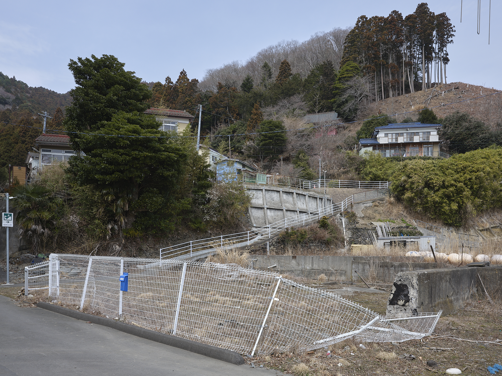
Echigoya-san went onto Orinohama after finding Hamagurihama by accident. We decided instead to head on to Orinohama first and make our way back to Hamagurihama and then the city. As we descended the road into the village, the view of the sea was replaced with the new sea wall to our left.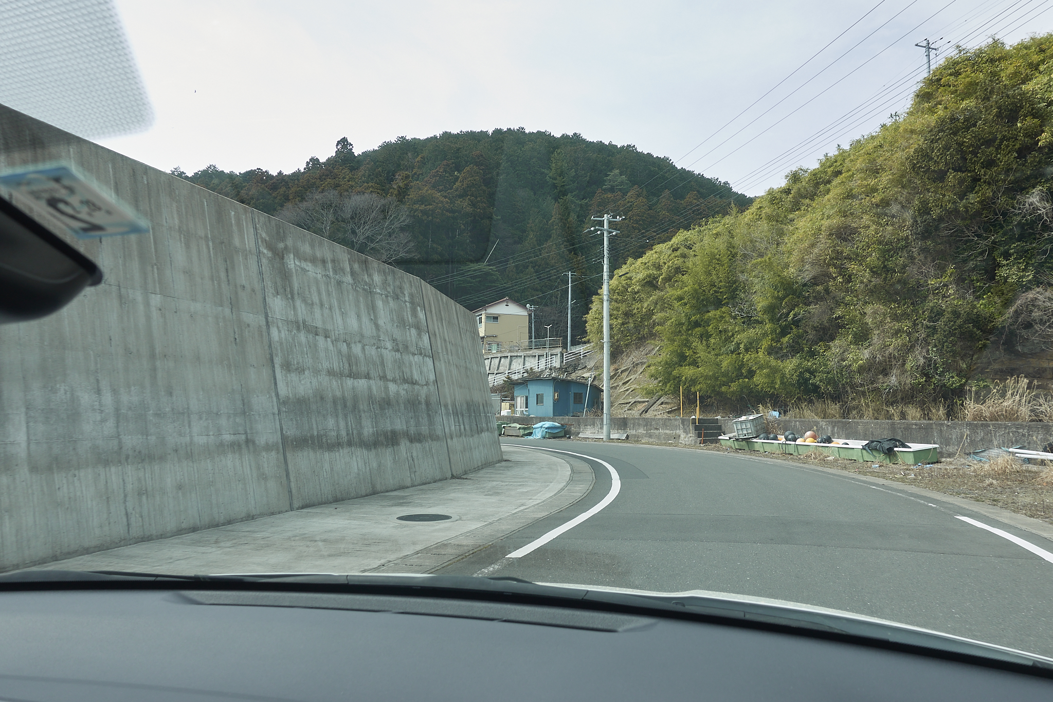
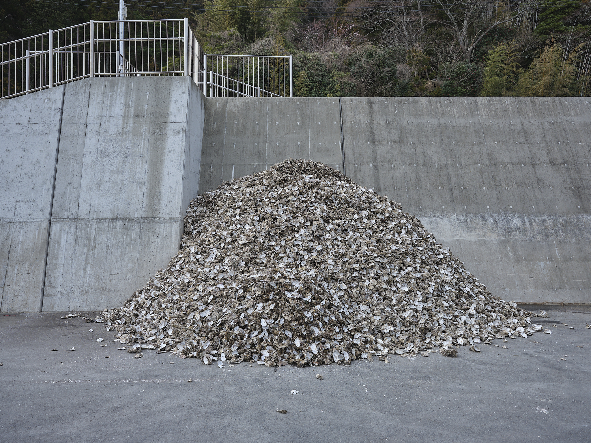
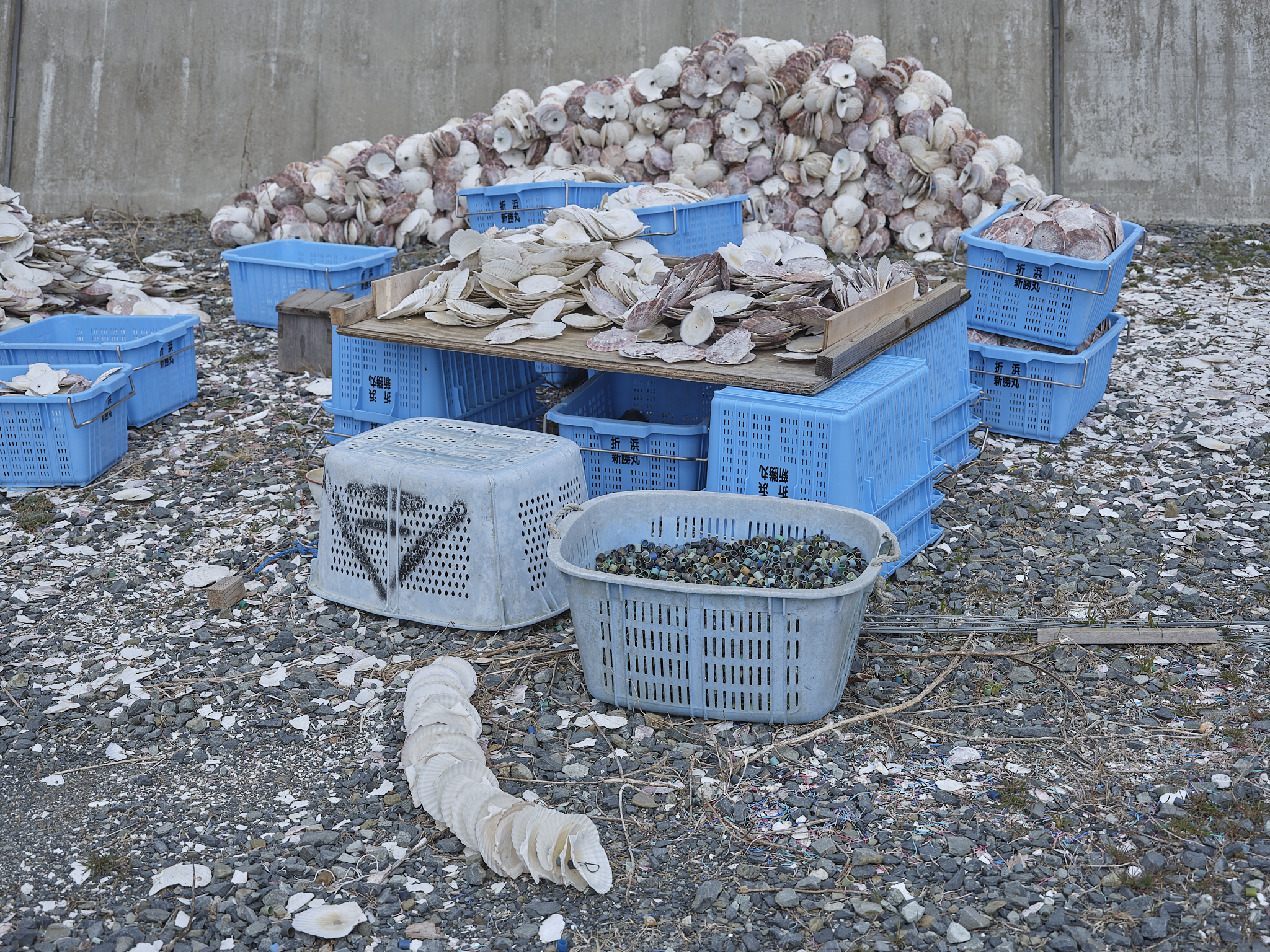
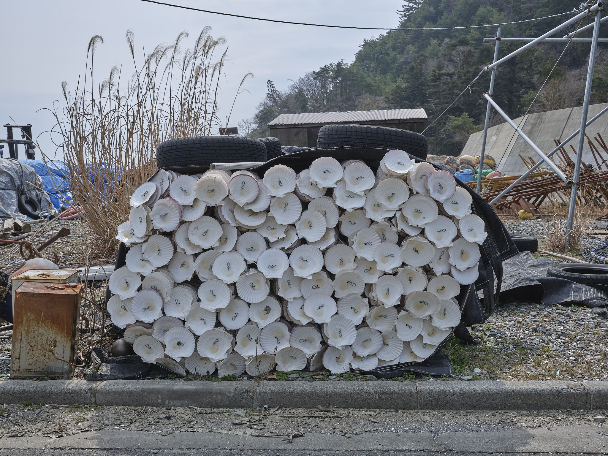
We drove further on to the end of the port where we encountered a familiar sight in these parts: oyster casings and scallop shells, a sign that business has returned in the thirteen years since.
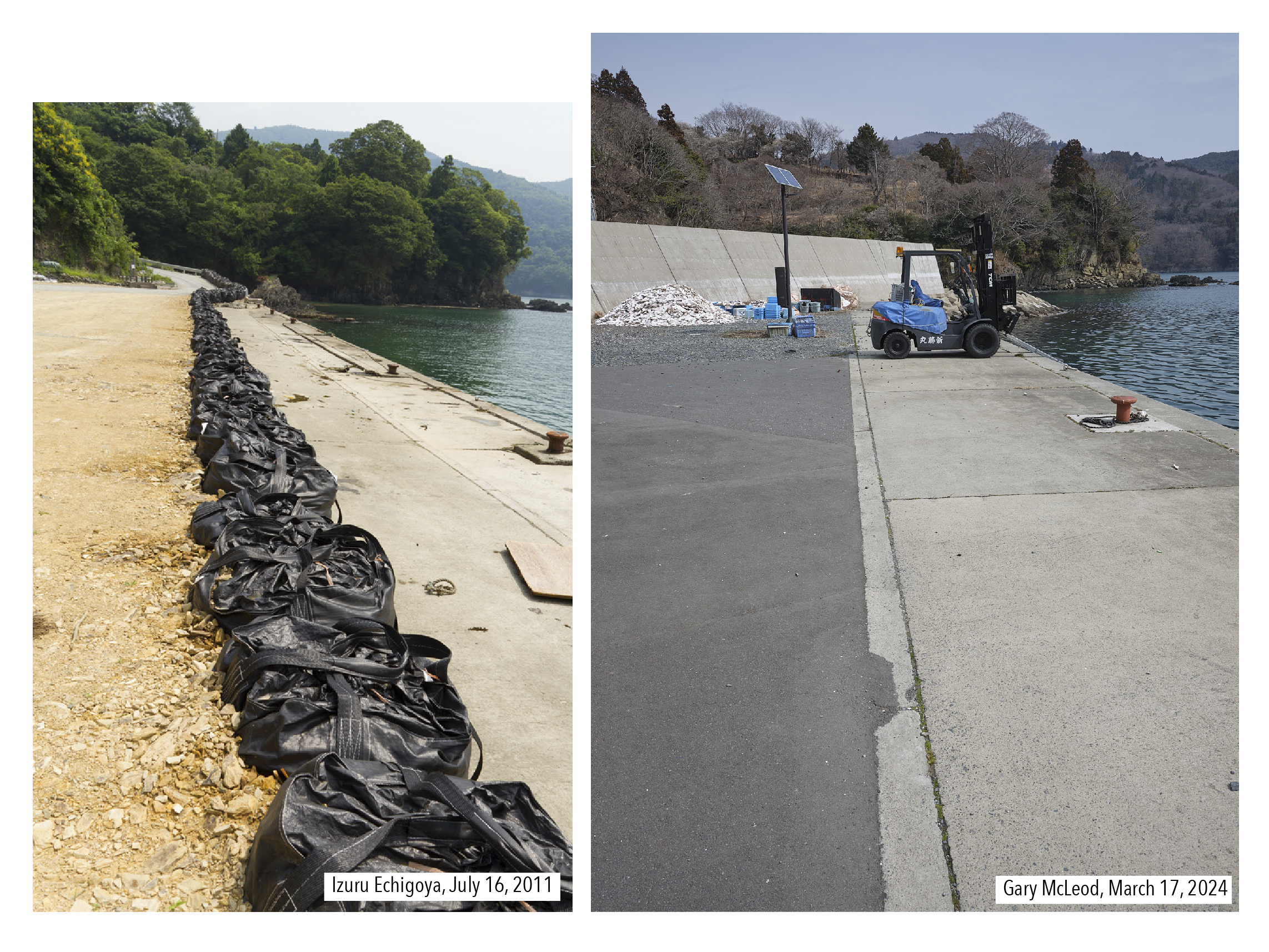
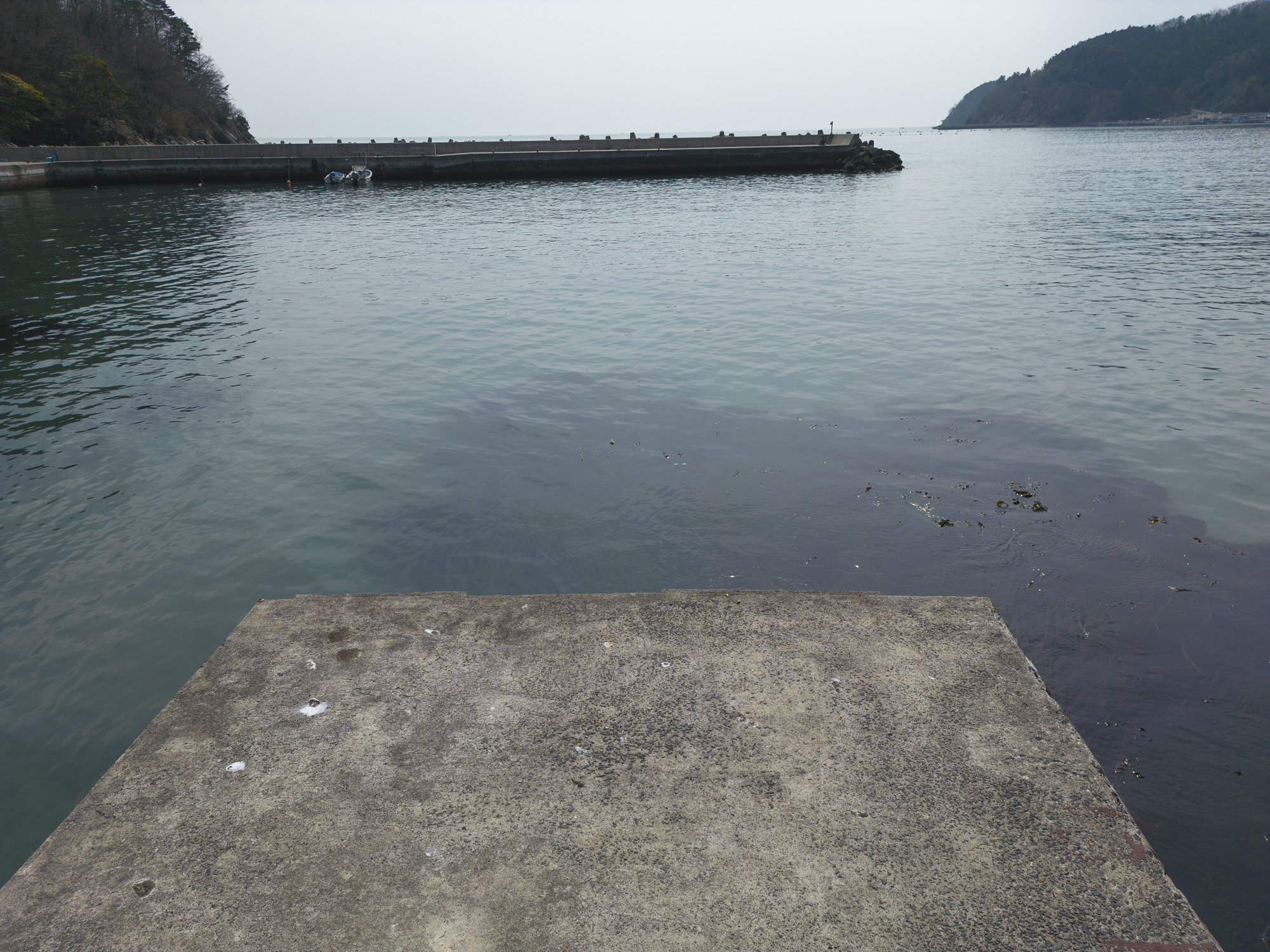
As we walked around the shore, we came to where Echigoya-san made the first posted image of the village looking south. Closer inspection will note the same building to the right of the frame now behind the tall sea wall when before it was protruding behind a damaged house. Others may also note the number of red moorings alongside the water’s edge. Although only four appear in our image on this side of the forklift truck, there is one more on the other side out of view.
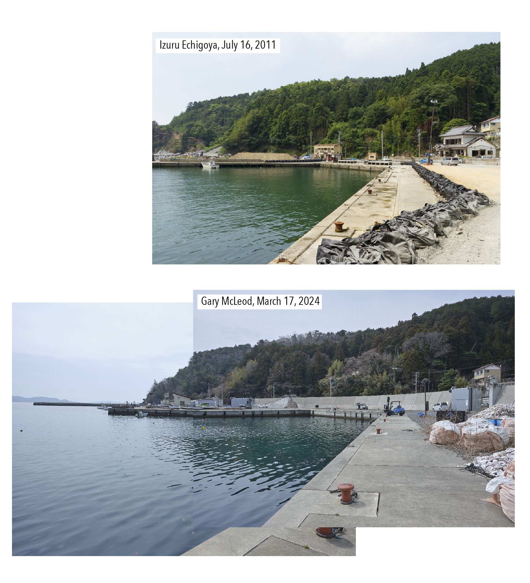
At first glance, there isn’t a great deal of change in the waterfront itself, although new concrete slabs appear to have been placed, suggesting that the moorings are an echo of their original positions. Viewing historical imagery for the location in the Google Earth Pro desktop application reveals that the waterfront was changed sometime between 2012 and 2015. Moreover, the biggest change (the sea wall) was erected sometime between 2015 and 2018, which now obscures the roadside from this vantage point.
A view looking northward by Echigoya shows the same view but from the other side. While in Echigoya’s image, we see a line of black bags leading to the road winding into the village, that view is now masked by the reasonably high sea wall and before that a solar panel. The cove behind the forklift has also been reinforced with wave breaking concrete structures. Of the foliage in the distance, three evergreen trees still stand tall despite the seasonal reduction of green.
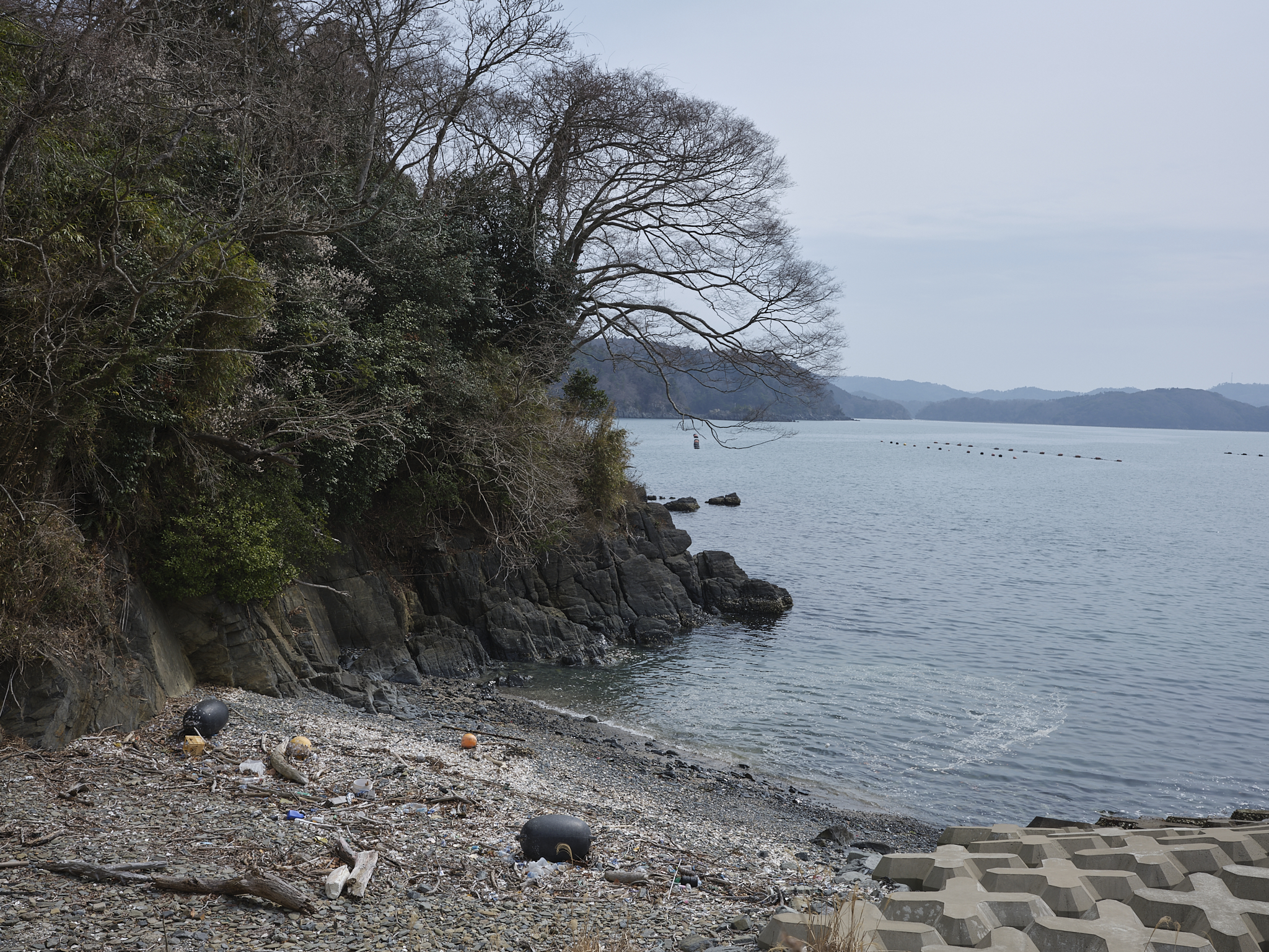
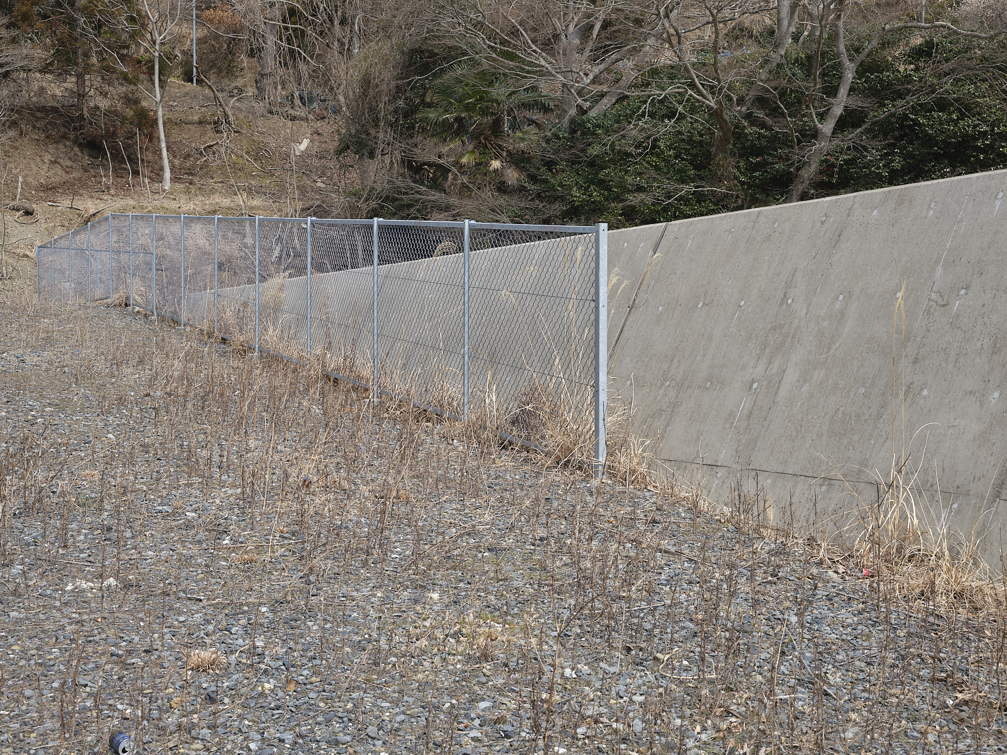
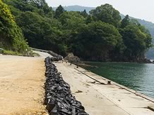
A current view of the cove itself presents a small beach with detritus. Such a view was obtained however by leaning over part of the sea wall – as it happens, a fence appeared to prohibit climbing the wall, not that it was necessary to see the cove.
Two remaining images by Echigoya were a few steps away from the others. Both directed towards the wrecked buildings. The first was found from the existing elevated building noted earlier. The damaged house in front was to the right of Echigoya’s frame. The concrete foundations appear to have two sets of steps, one in view behind the blue car, the other perhaps masked by the pick-up truck. It is worth noting two details here. One is the location of the utility pole (near the visible steps) as being more or less in the same place. The other detail is the length of the foundations which is considerably shorter now, and replaced in part by a metal fence.
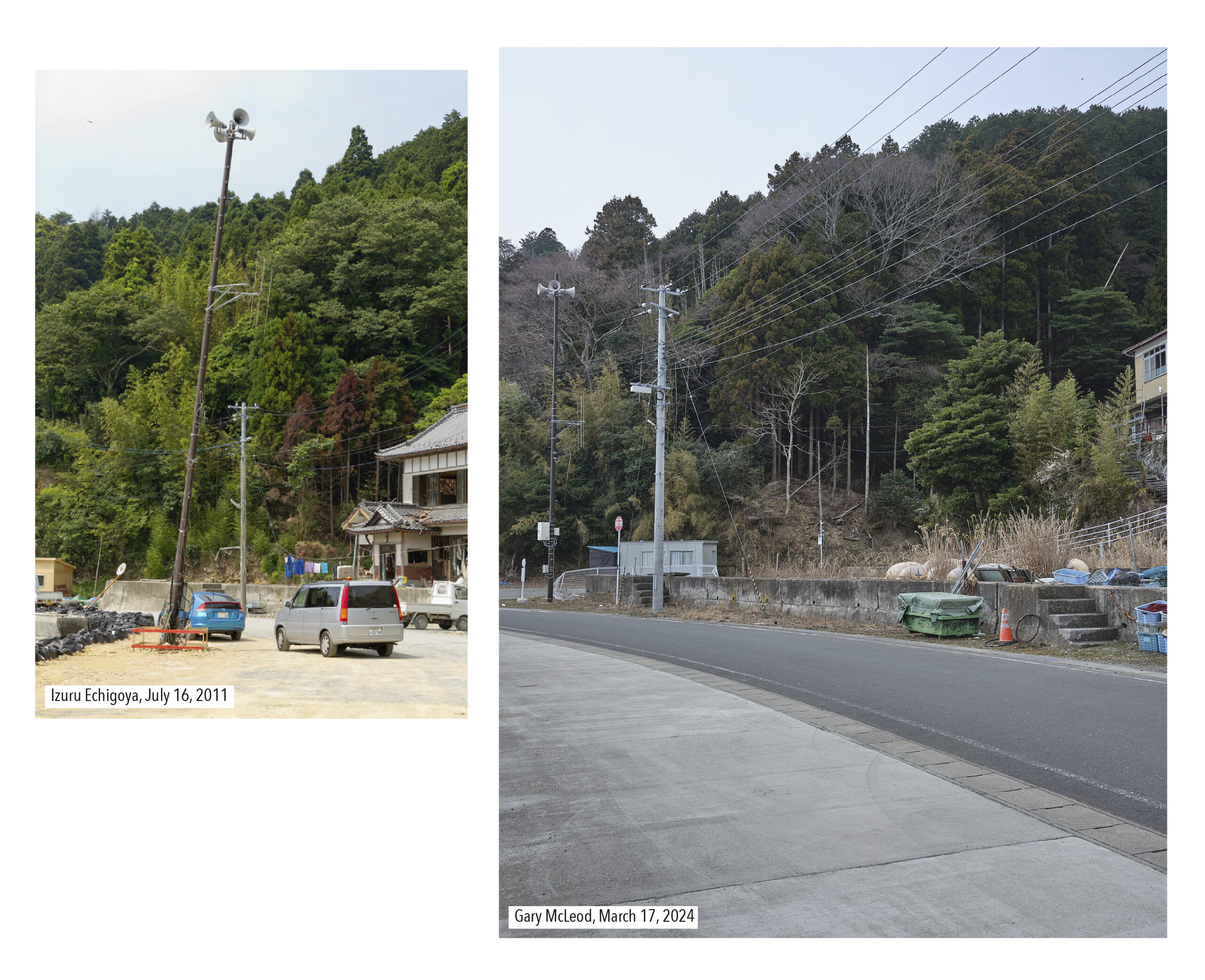 That metal fence has also bore the brunt of time or an accident of some kind. The concrete foundations can be seen in the image below to have been cut, although that was some time after the tsunami given how intact it was in 2011. It was at this point that we could note the same houses as those which Echigoya had referred. Wondering about who still lived there, our attention was drawn to someone shouting into one of the houses to get a resident’s attention for something, shouting which resonated around the shore.
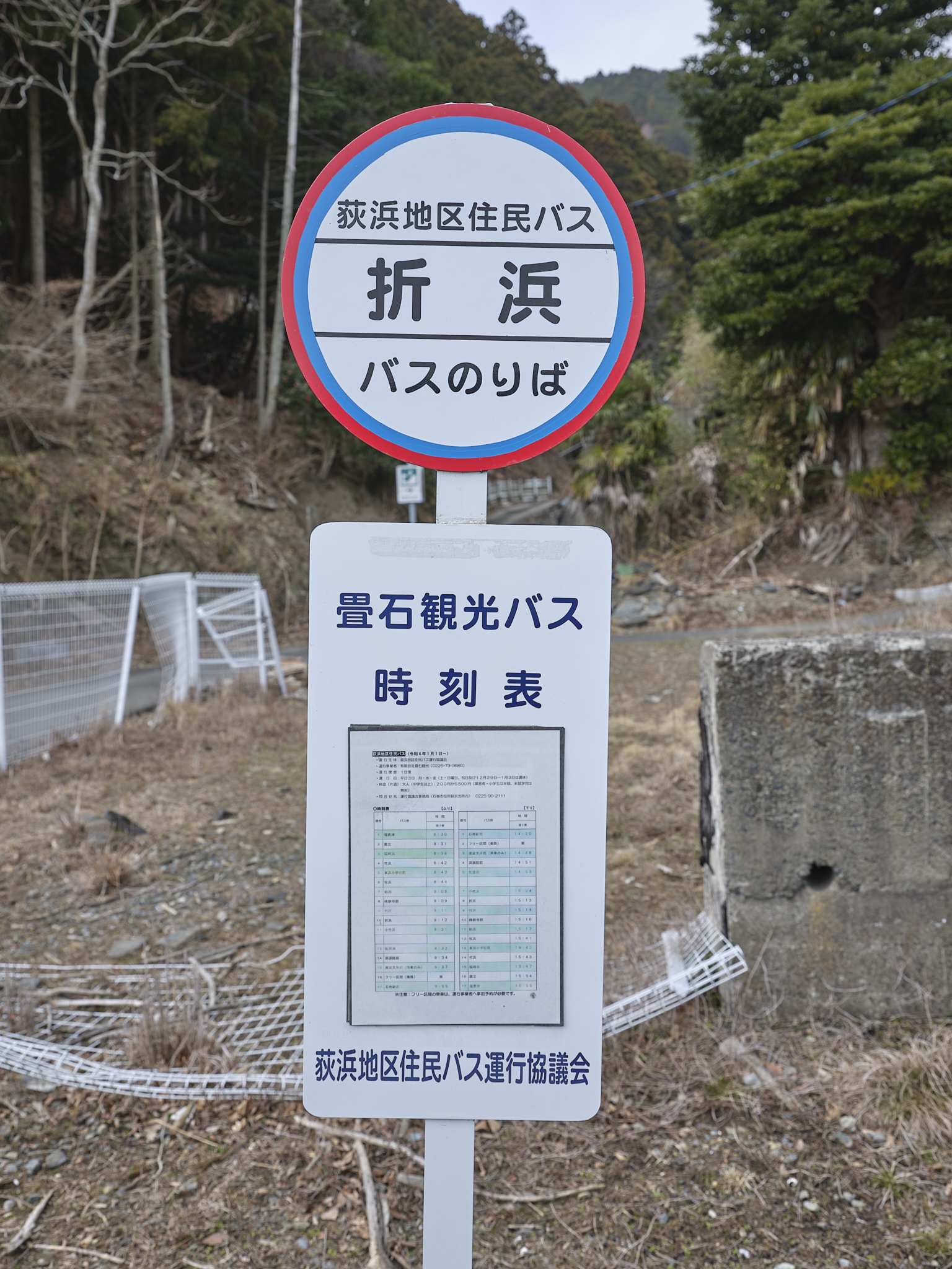
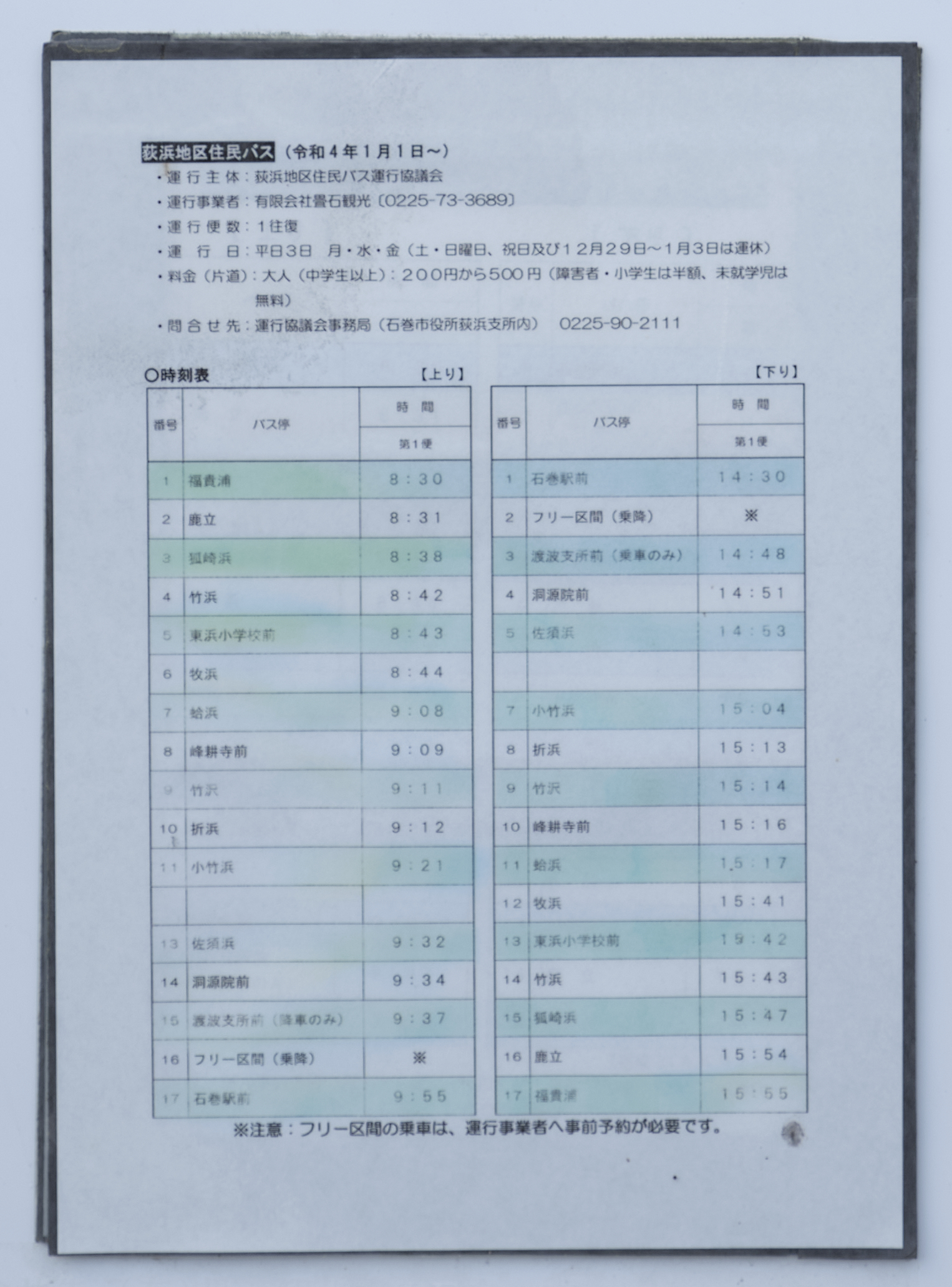
On that note, we couldn’t help but notice the timetable for the bus stop, surely a token endeavour for these parts with one morning bus to Ishinomaki and one afternoon bus back.
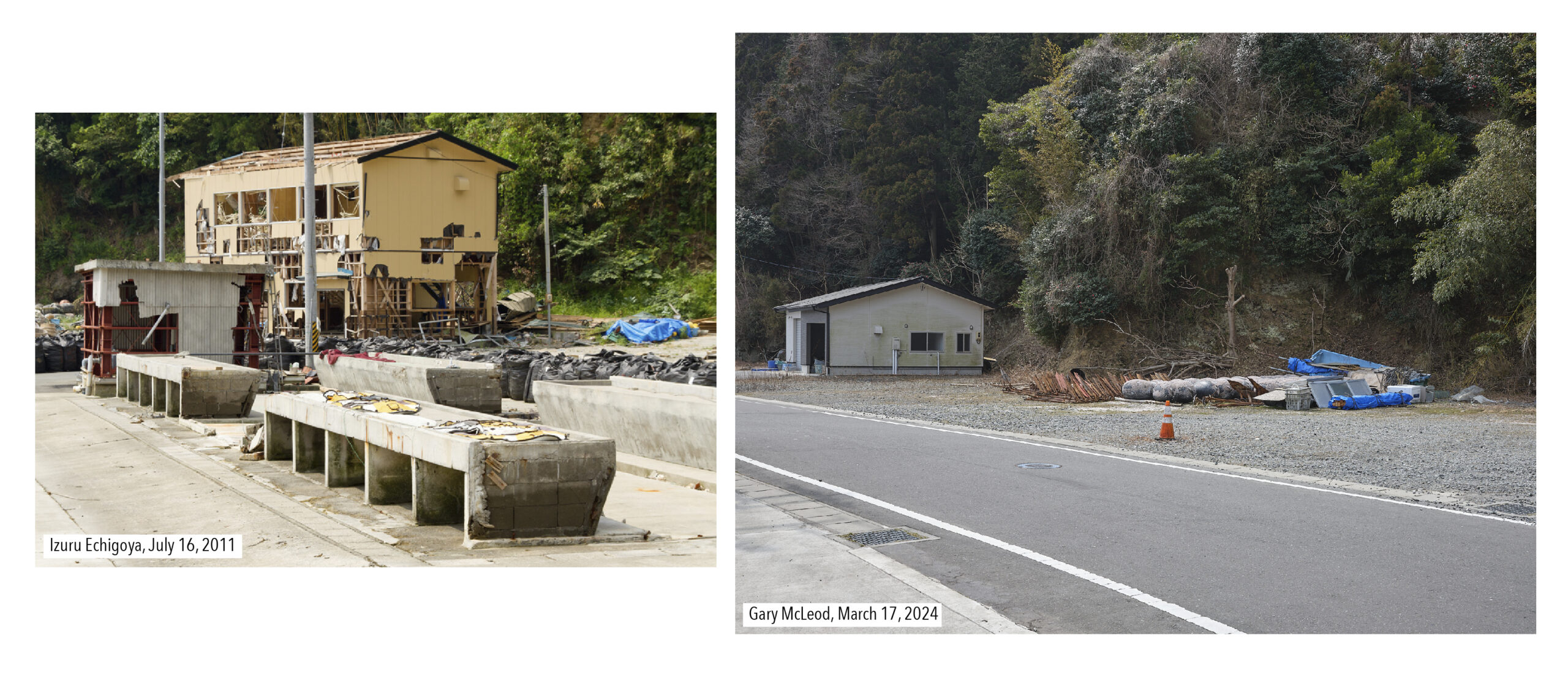
The last of Echigoya’s images was a closer image of a wrecked building which had since been erased. We could not be sure of this image’s location other than the depth of trees and foliage in the distance. Thus, our image is an approximation based on the appearance of the wrecked building in the first image and the proximity that the sea wall would allow given how it separated the road from the sea.
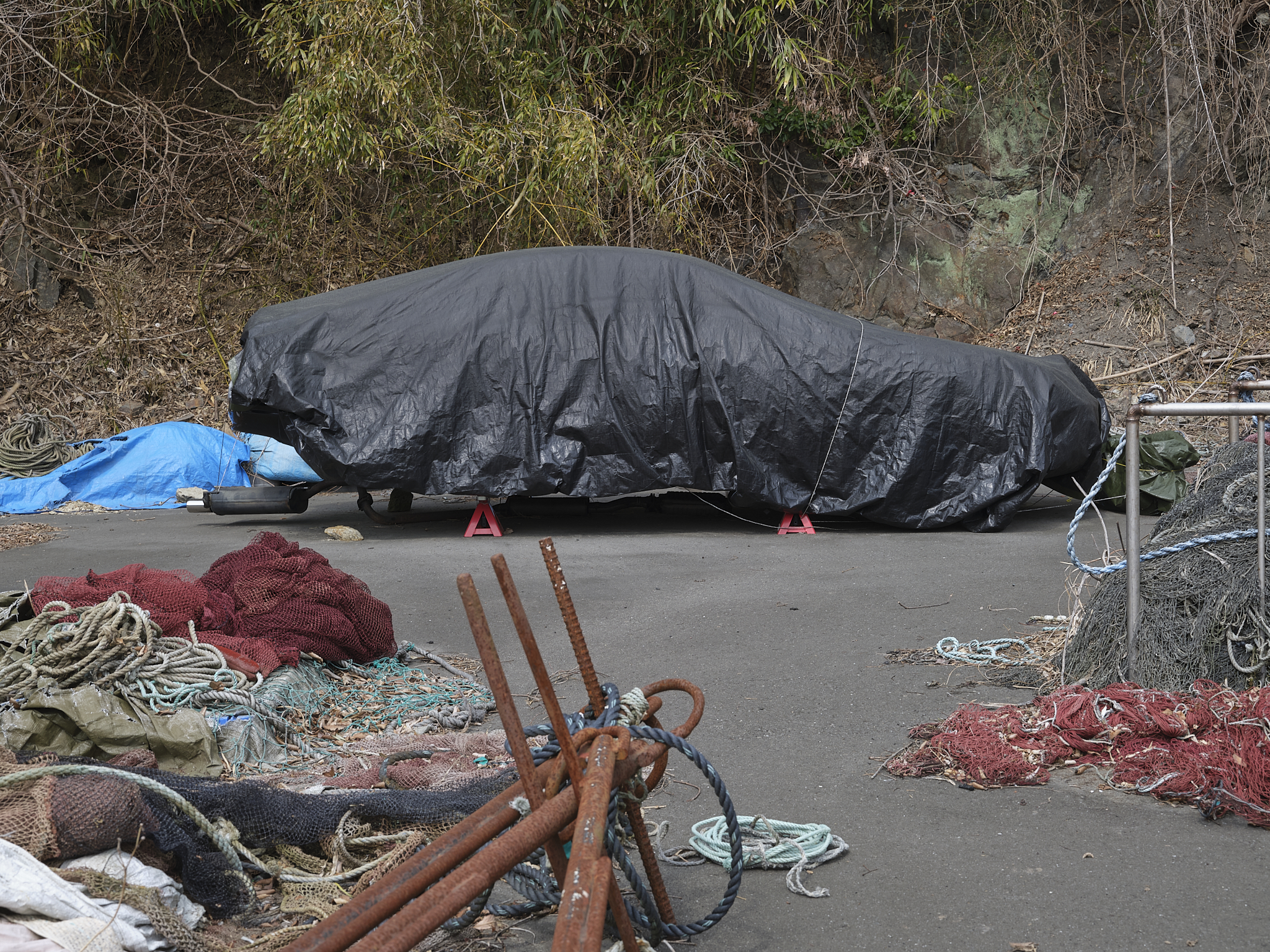
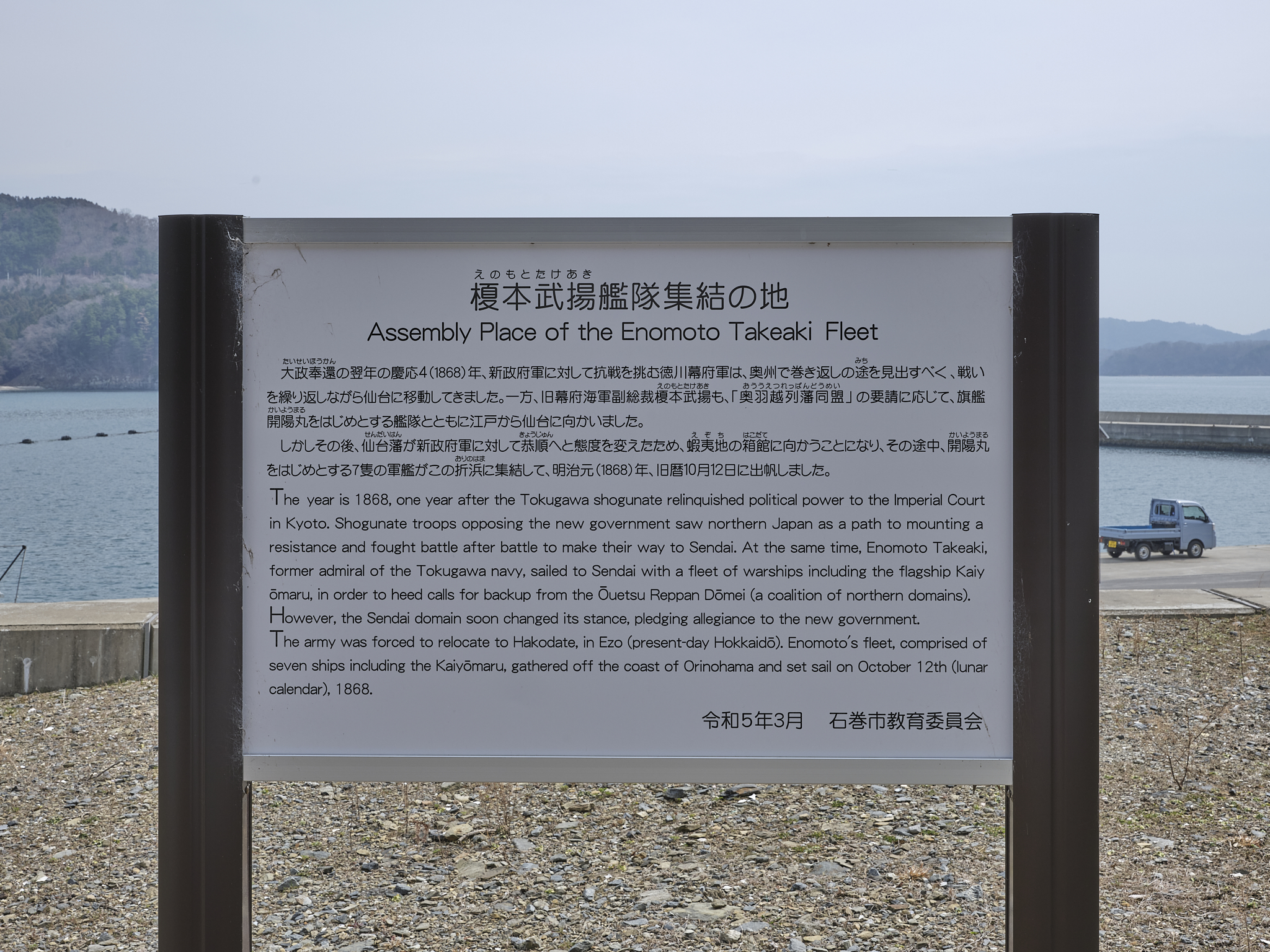
Experience rephotographing has taught me to see other things of note. On this occasion, I could not help but notice neatly threaded Scallop shells ready for oyster cultivation and what appeared to be a (wheel-less) car of some kind under black tarpaulin, both signs of life persisting in this fairly remote village. One further detail of note was a commemorative information panel installed as recently as the month of our visit. The panel recounted how the Enomoto Takeaki Fleet of seven ships assembled off the coast of Orinohama on October 12, 1868 before it would retreat to Hakodate. With that, we headed back to Hamagurihama, albeit not in retreat.
※These rephotographs were produced during fieldwork funded by the DNP Foundation for Cultural Promotion.
Next page
Hamagurihama: Oshika peninsula rephotographed, part 1
Related posts
Orinohama, Ishinomaki, Miyagi
Hamagurihama, Ishinomaki, Miyagi: A Quiet Sea
| Recorded on | March 17, 2024 | |
|---|---|---|
| Recorded by | Gary McLeod | |
| Recorded at | Orinohama, Ishinomaki, Miyagi | |
| Keywords |
Related Post
Hamagurihama, Ishinomaki, Miyagi: A Quiet Sea
On our way to Kobuchihama, we got lost and at the end of the road, we found Hamagurihama beac...
Hamagurihama
March 17, 2024 This is the second of two reports revisiting images made for the Recorder 311 ...
Orinohama, Ishinomaki, Miyagi
Going further from Hamagurihama, we come upon Orinohama. Here houses are built on stones pile...
Onagawa Town Fixed-point Observations
■View from Onagawa Town Regional Medical Center (panoramic view facing north) (A) April 23, 2014 (B)...