


Two stations, a shoe, and a railroad crossing
Natori, May 29, 2024
Picking up the rental car, our plan was to drive from Natori in Miyagi Prefecture to Iwaki in Fukushima Prefecture. The night before, I received a kind email with links to Recorder 311 articles that we might find along the way. Whereas previews of our route from Google Maps and Google Street View had presented a broad coastal hinterland, images in the links received activated it, giving us two layers through the car window: a ‘before’ to our ‘after’. The only problem was that the layers didn’t line up.
What follows is an account of rephotographing pictures made in Yamamoto Town by Hiroko Sato(link). On May 13, 2011, Sato-san posted her photographs to the Recorder 311 website detailing what she found there. Being a former teacher at the Yamamoto Town Junior High School, the landscape she encountered would have been non-sensical to anyone else, but memories gave her access to making sense of what had become unfamiliar. In turn, her pictures gave us access to making sense of the alignment issue. I won’t describe our rephotographic experience in chronological order; rather I will describe it terms of how understanding grew. It makes sense to start with Sakamoto station. 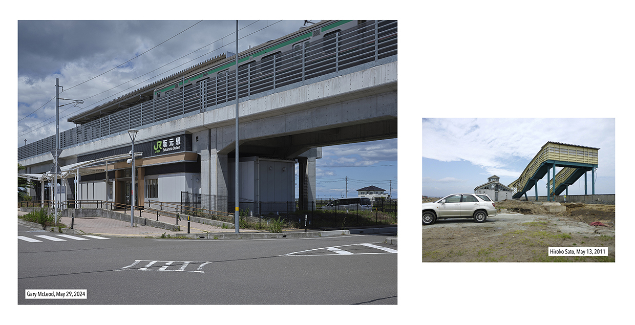
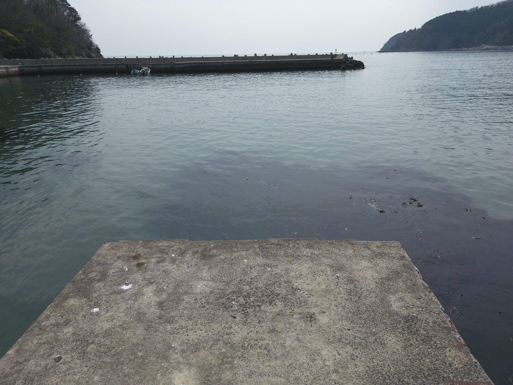
It wasn’t difficult to find the station, except that it wasn’t where we should have expected to find it. The reason for a difference in scale between Sato-san’s image and ours is position. The size of Sato-san’s image suggests how close the train station used to be from its current position, which is now much further from the sea.
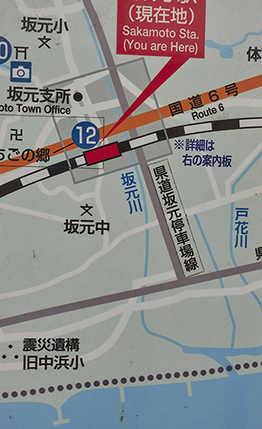
The map at the station didn’t convey the change, but the historical imagery on Google Earth (in this case 2009) showed both the current station and the old station indicated by the buildings around it. This is the alignment issue mentioned above. The new station simply didn’t map onto the old one, but our angle was at least right. This created a question about what to rephotograph. Should we rephotograph the former position of the station or the current position? So, we did both.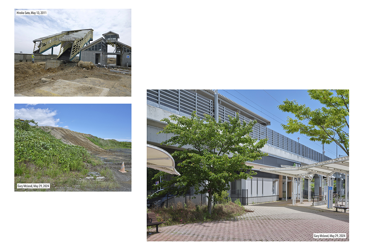
Again, in our image, rephotographs are positioned according to distance from the original station (two images on the left are closer to the sea; the image on the right further from the sea). The current view of the old station (bottom left), however, was more of a generalization.
GE (Google Earth) historical images from April 2011 (one month before Sato-san’s image) revealed what we got right and what we got wrong. The angle of Sato-san’s image was suitable, but our position should have been across from what was now a road. This was easier to determine with the virtual tools having had the experience of the site, but any image was likely not possible from that position were we to take it. It should be noted that the current GE data showing was only for 2023 and didn’t seem to match from above what we saw at ground level as it was still in the process of being reformed. Another time, we will try again.
What we may have gotten right (or at least closer) was a sign photographed by Sato-san that welcomed visitors to the town of Yamamoto.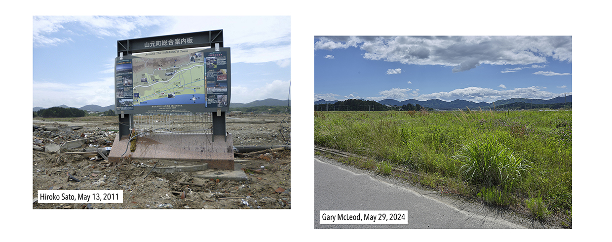
Looking at the mountains in the distance, we were facing the right direction, but Google Street View (GSV) data from 2012 showed that the position was too far away from the train track. Although the correct position was likely buried, I still feel my memory of the position was closer than what the virtual tools data suggested.
Once the alignment issue between old and new train stations was rationalized, other scenes became more straightforward. A roadside view of a cabinet was identifiable on GSV as well, although the foundations were hard to identify in the present day.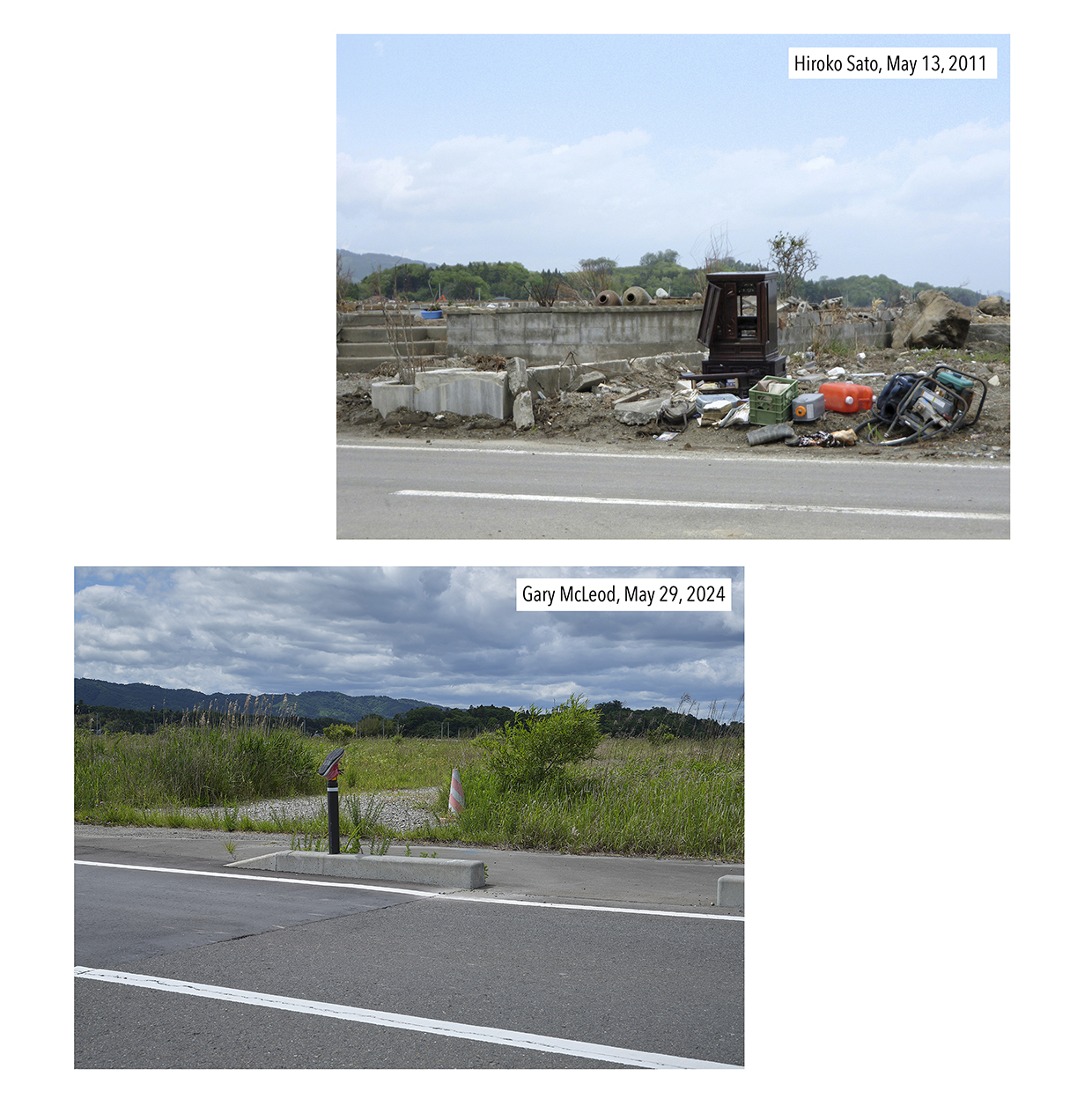
Our search for the foundations may have been distracted by a lost shoe that had been placed on a bollard in the view. Hopefully, it found its owner!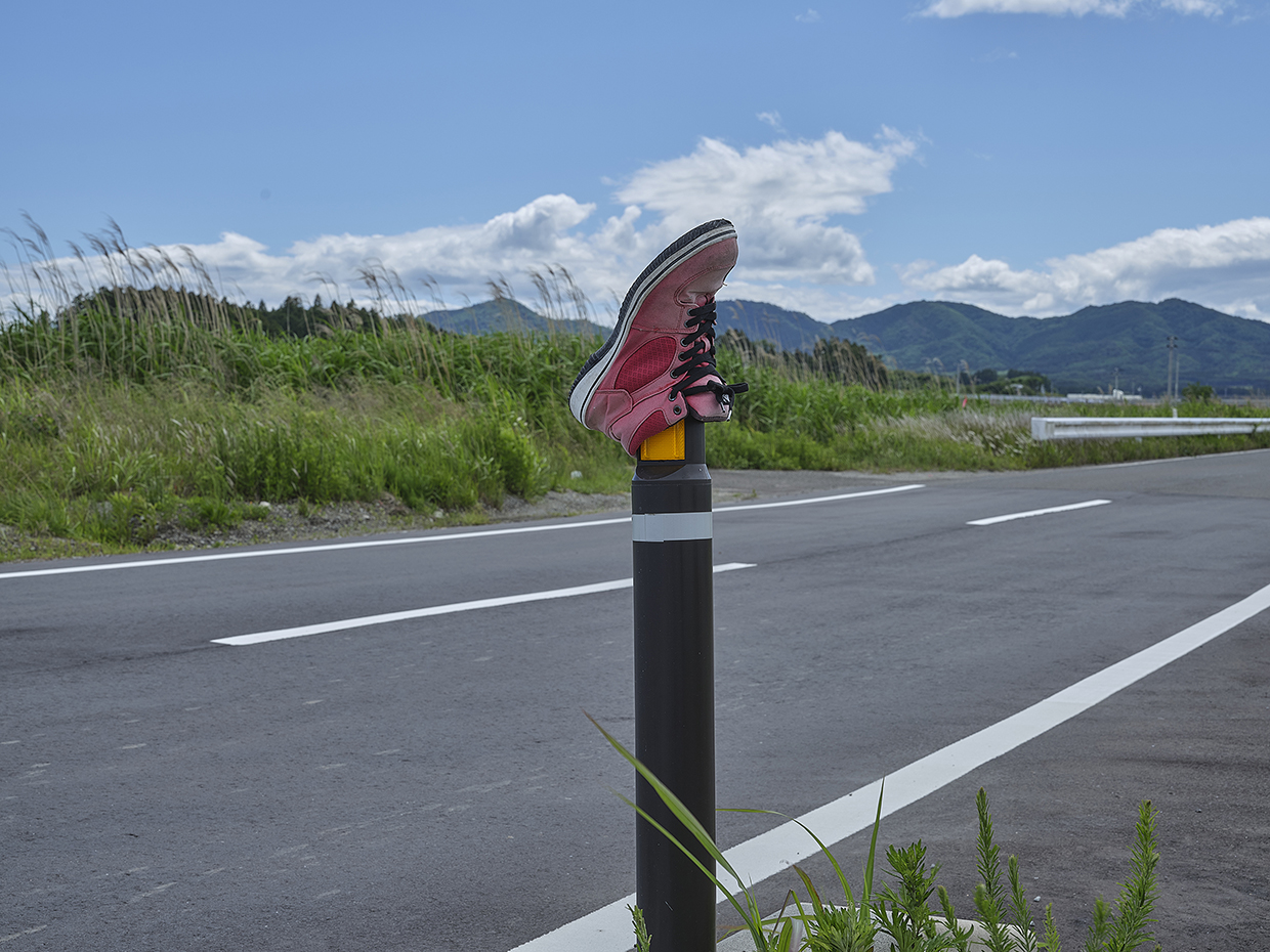
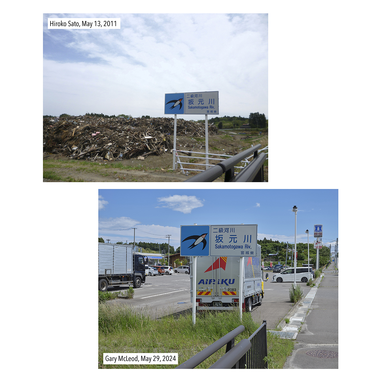
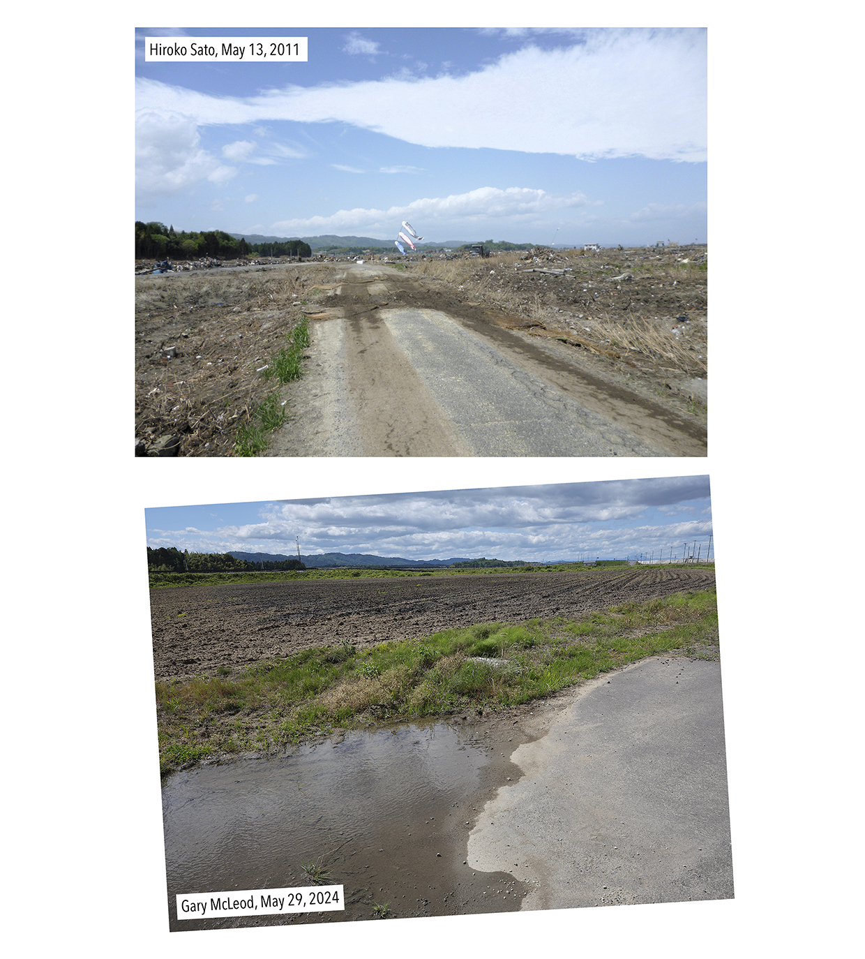
Two other images by Sato-san were rephotographed earlier in the visit after parking up at Lawson for lunch. A short walk from the convenience store, one image looked toward the river; the other toward a road sign for the town. These were the first two images in Sato-san’s report, noting that the water reached as far as Route 6, from where both images were made.
Of the river image, I felt it was important to mimic the tilted angle. This was to maintain continuity between the scenes. The original bridge remained in the background, but the repositioned (and now elevated) trainline required a new bridge, which dominated the composition. The current Sakamoto station was where detritus was piled up in Sato-san’s image (to the right).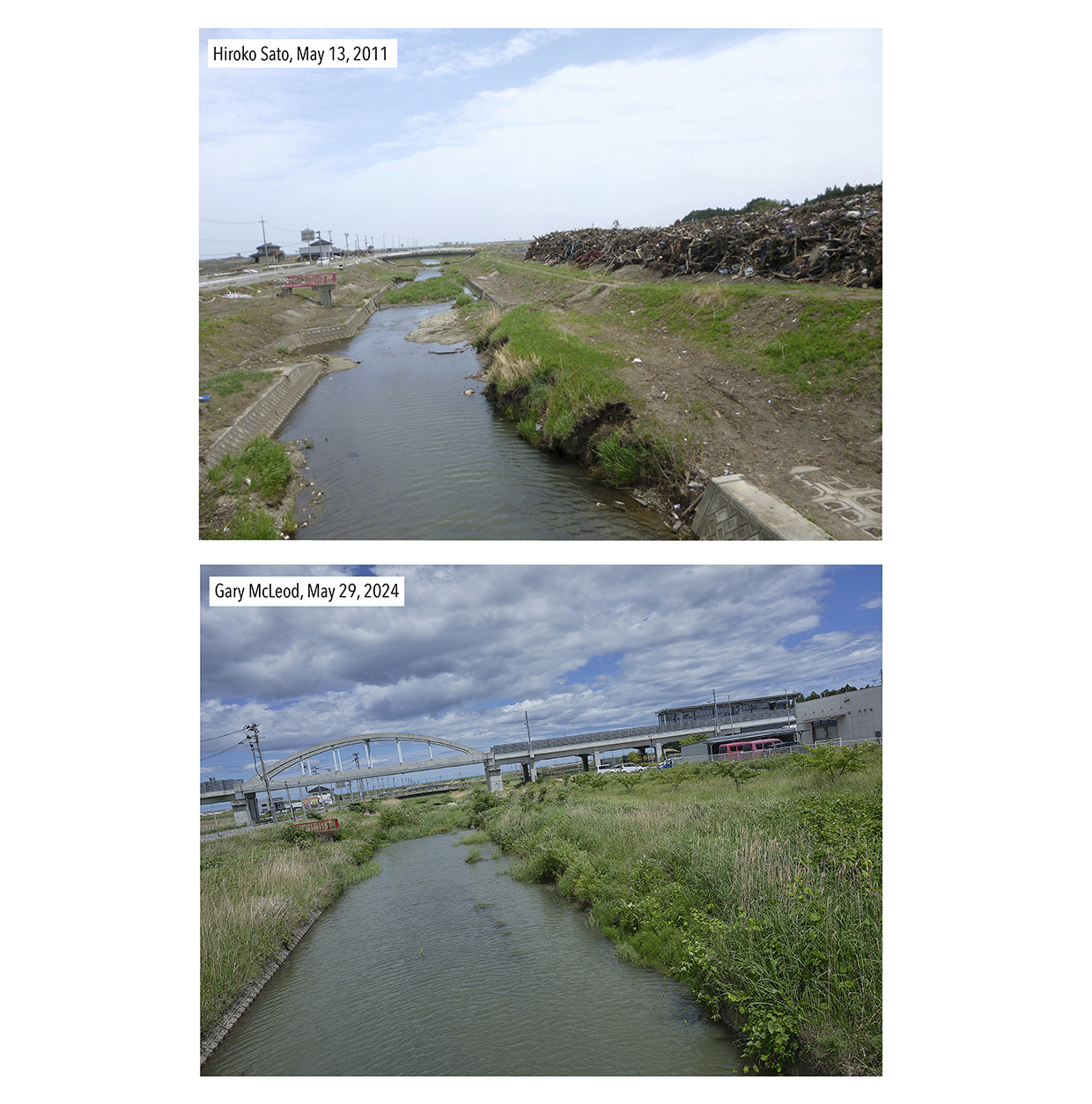
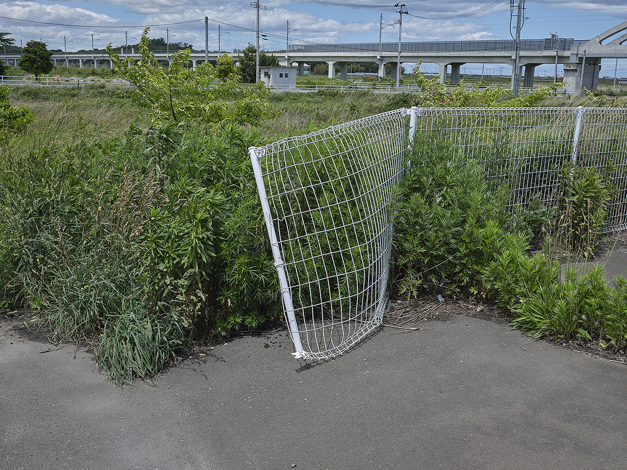
Of the Yamamoto Town road sign image, the Lawson convenience store sat where detritus can be seen behind. The sign itself appeared not to have changed, but it is hard to tell from the resolution of the original image at the time. That said, the sign had the same design. The bridge railings also appeared the same, but it couldn’t be determined if the sign had been moved or not. Nearby white railings appeared damaged, but possibly due to a vehicle as they looked a lot newer.
A further image by Sato-san remarked of the Junior High School, presumably the one where she once worked. As the school appeared larger in our frame, it may have been that we were too close, with Sato-san perhaps being closer to the bridge (as seen in the river picture above). We could not account for the difference in trees, although the light might have something to do with it. GE historical imagery could not confirm any change to the vegetation around the school either – likely there was no significant change because it was out of harm’s way.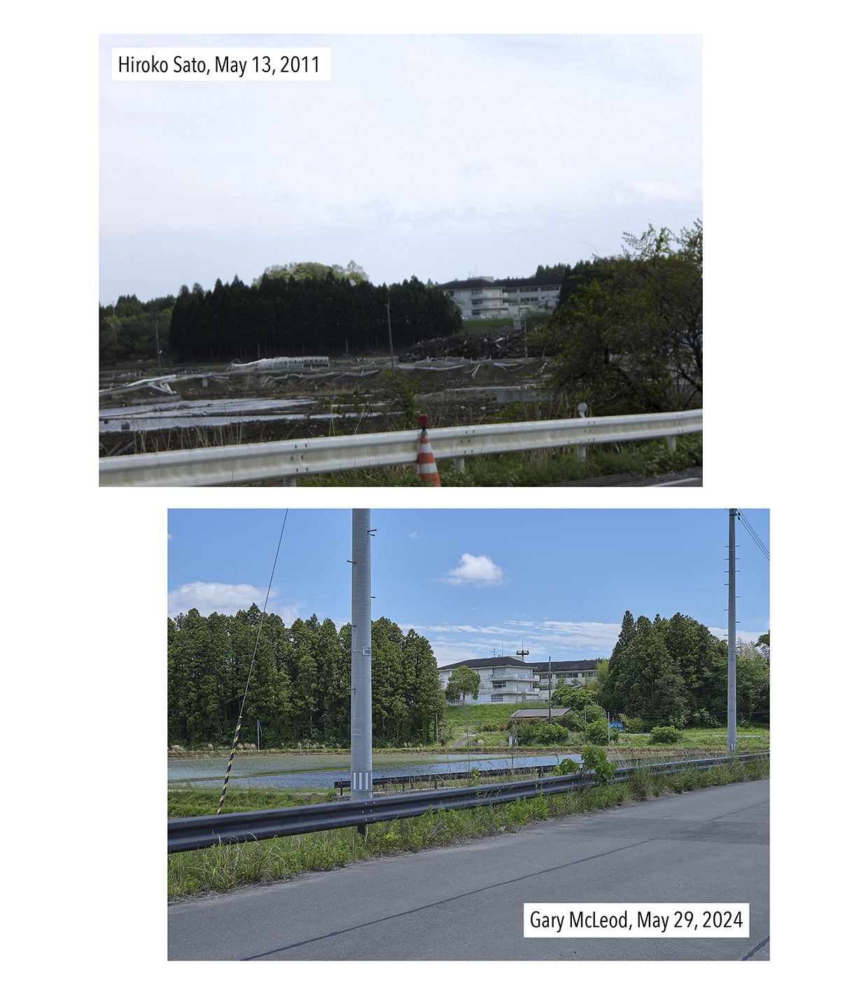
It was interesting that there were more images in Sato-san’s post than words. Words can be difficult to use when engaged so much visually with a scene. The temptation with our rephotographs was the same because it was such an intense visual experience (as rephotography ought to be). For this reason, we did not rephotograph everything, but we tried to concentrate on what might have been key moments (i.e. damage to the station, standing at Route 6 where the water likely reached, and the school). In doing so, we got a sense that Sato-san may also have been trying to visually grasp the scale of what she was seeing.
The last rephotograph we’ll discuss is that of a koinobori flag, placed where a road had crossed the train tracks.
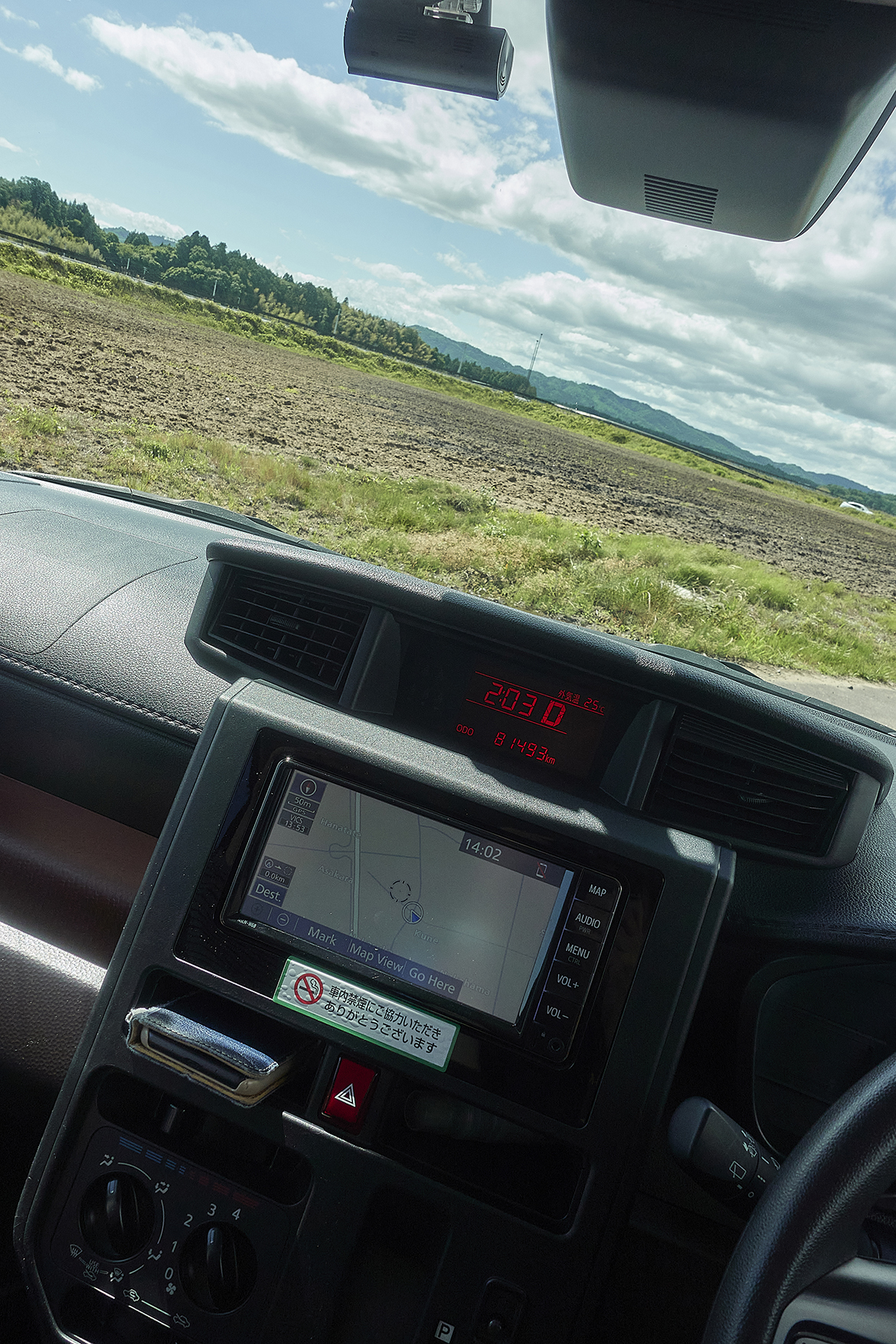
Knowing now that the old trainline was now the highway, it became a matter of looking for where the road is or was. GE historical imagery made it possible to recognize the roads around the area as consistent apart from one road that crossed the tracks, which was now a field. The car navigation also told of a road.
The entry to the road-now-field still had concrete, but it just stopped, as if the field itself had overrun it. As can be seen in our rephotograph, the mountains and treeline behind confirm the position.
The koinobori flag is traditionally put up in honour of children’s day, so it may be distressing to learn the real reason why it would have been placed there. Sato-san makes no mention of this either, but she did make an image of the flag as if on the crossing itself. Getting to that point meant parking the car by the roadside and walking up to the highway where there remained a ‘crossing’, albeit one for farmers.
Although higher than what was the railroad crossing, we could situate Sato-san’s image in the present context, but only roughly because there was nothing in the background to correlate. At this point, hope was all that mattered for us in confirming its position.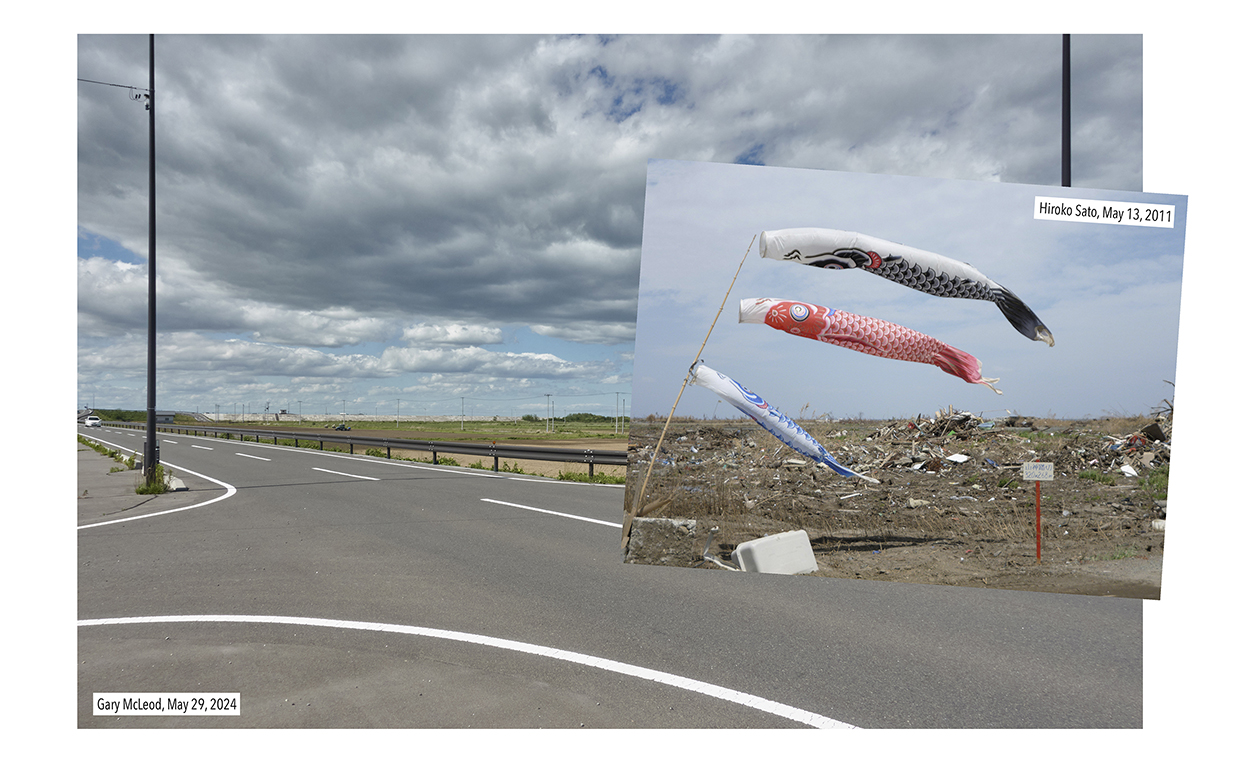
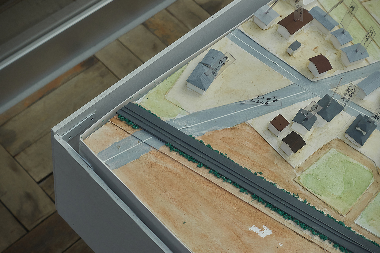
Following that rephotograph, we visited the Nakahama elementary school which had been preserved as a memory for the future and had won design awards in doing so. The tour of the school was a lasting memory, for sure, but it contrasted sharply with the memory of the land itself and the strong howling wind. A model of the school and its surroundings was a notable highlight during the tour, but perhaps not for the reasons expected. There, at the corner of the model, was the railroad crossing.
It didn’t matter that the representation of the crossing was simple. It mattered more that someone cared enough to include it. The model was about the elementary school, but for the kids once going to that school, that railroad crossing was probably a highlight. So, maybe that explains the koinobori flag. Well, I am happy to believe so.
※These rephotographs were produced during fieldwork funded by the DNP Foundation for Cultural Promotion.
Related posts
Orinohama: Oshika peninsula rephotographed, part 1
Hamagurihama: Oshika peninsula rephotographed, part 2
「2011年5月13日の山元町の記録(in japanese)」
| Recorded on | 29 May, 2024 | |
|---|---|---|
| Recorded by | Gary MacLeod | |
| Recorded at | Yamamoto-cho, Watari-gun, Miyagi | |
| Keywords |
Related Post
Orinohama
March 17, 2024 Having stayed the night in Ishinomaki and looking at the map of the Recorder 311 webs...
Hamagurihama
March 17, 2024 This is the second of two reports revisiting images made for the Recorder 311 ...
Onagawa in January 2012 (Part 1)
For each pair of pictures, the upper photograph was taken in April 2011 and the lower one in ...
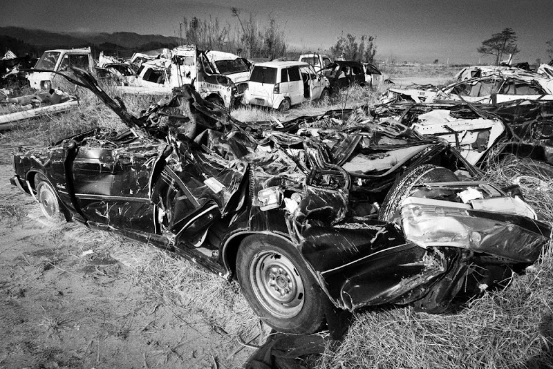
Discarded Cars in Yamamoto, Watari District, Miyagi
In Yamamoto, Watari district, Miyagi, a throng of cars discarded after the tsunami are piled up on t...