Natori City Fixed-Point Observation Photos
■Natori Municipal Yuriage Junior High School
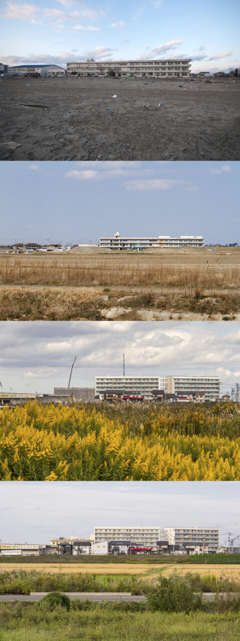 (A) March 24, 2011
(B) March 28, 2016
(C) October 22, 2021
(D) October 3, 2023
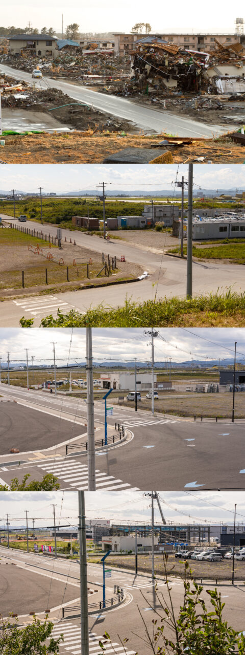
■View to the north from Hiroura Teizan Bridge
(A) March 28, 2016
(B) September 8, 2017
(C) October 22, 2021
(D) October 3, 2023
(latitude, longitude: 38.166030, 140.947970)
(C) The junior high school was demolished in 2015, and a supermarket and disaster reconstruction public housing have since been built in the surrounding area.
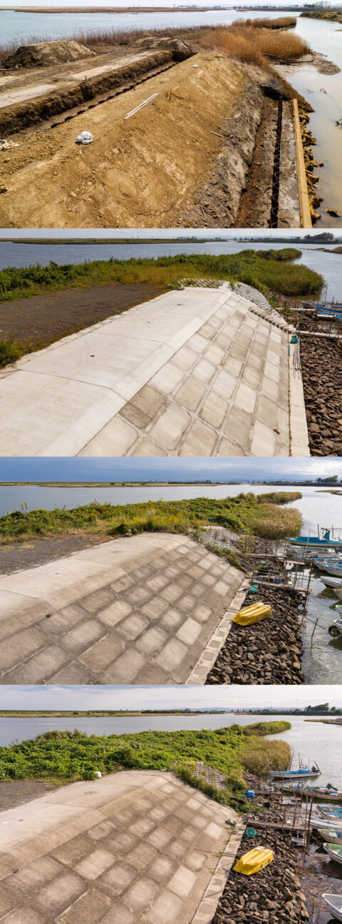
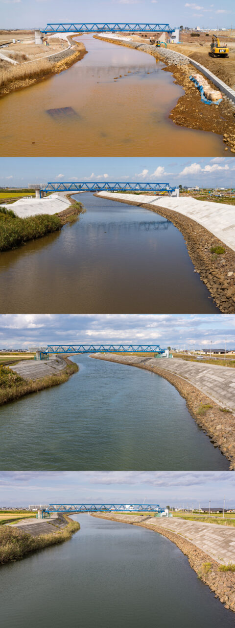
■Around the Seawall Near Hiroura Teizan Bridge
(A) March 28, 2016
(B) September 8, 2017
(C) October 22, 2021
(D) October 3, 2023
(latitude, longitude: 38.165800, 140.947760)
(C) The once-brand-new seawall was blending into the surrounding landscape by 2021.
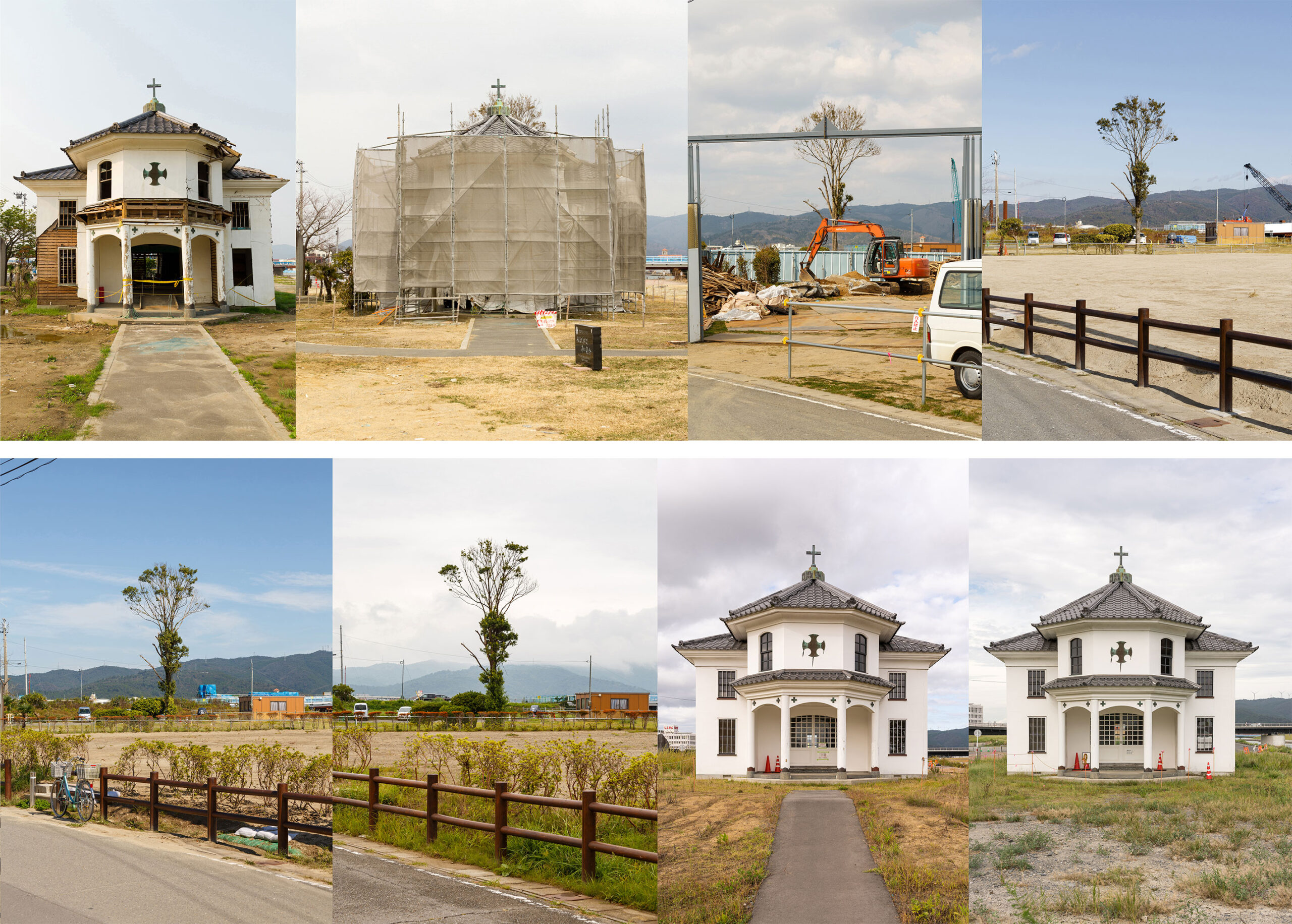
■From Yuriage Mount Hiyoriyama (1)
(A) March 31, 2011
(B) September 8, 2017
(C) October 22, 2021
(D) October 3, 2023
(latitude, longitude: 38.172390, 140.953700)
(C) The entire Hiyoriyama area was designated a disaster hazard zone, and in May 2019, Natori City established the Natori City Disaster Memorial Park there.
(D) The building seen in the distant left background is Yuriage Chuo Daiichi Danchi (disaster reconstruction public housing), completed in 2017.
[Recorder]
ECHIGOYA Izuru
photo of March 24, 2011:KITANO Hisashi
[July 18, 2024 Published]
[Related Article]
・Mt. Hiyoriyama on December 13, 2011
| Recorded on | March 24, 2011 to October 3, 2023 | |
|---|---|---|
| Recorded by | ECHIGOYA Izuru, KITANO Hisashi (recorder311 staff) | |
| Recorded at | MIyagi Prefecture, Natori City, Yuriage | |
| Series | ||
| Keywords |


